
If you want to put your body to the ultimate test, just hit up the most difficult hikes in the Great Smoky Mountains. You won’t just get to see what you can do, but also have a chance to experience all the wonders of the mountainside from a whole new perspective. It really doesn’t get any better than that! To figure out where to get your challenge on, just use this guide to learn about four trails that will make you put out all the stops.
Mt. LeConte
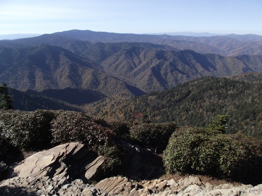
To see the beauty of Mount LeConte, you just need to trek 13 miles roundtrip starting from the Rainbow Falls Trail. Along the way, you’ll have to weather a fierce uphill battle full of rocks, roots, and stretches of ice.
There’s plenty of waterfalls all along the 13-mile path, any of which you can use as the perfect spot for a picnic on your way up the mountainside. In addition to that break, you’ll want to take lots of brief rests to recharge your batteries and get ready to continue with the brutal ascent.
The two small caves on this route are both superb spots for a break. While chilling under the rock overhangs, you can enjoy shade from the sun and get a close look at the impressive geological formations.
If you move at a steady clip, you’ll likely make it up to the top in about four hours. The view will undoubtedly keep you captivated for a while, just remember to leave enough time to trek back.
Mt. Sterling
Although there are many ways to reach Mt. Sterling’s summit, the most challenging route is along Baxter Creek Trail. To get to the top, you’ll have to hike 6.2 miles in, which boasts an elevation change of 4,200 feet. Then, on the way back, you get to reverse course and try to handle the steep descent for a total of 12.4 miles.
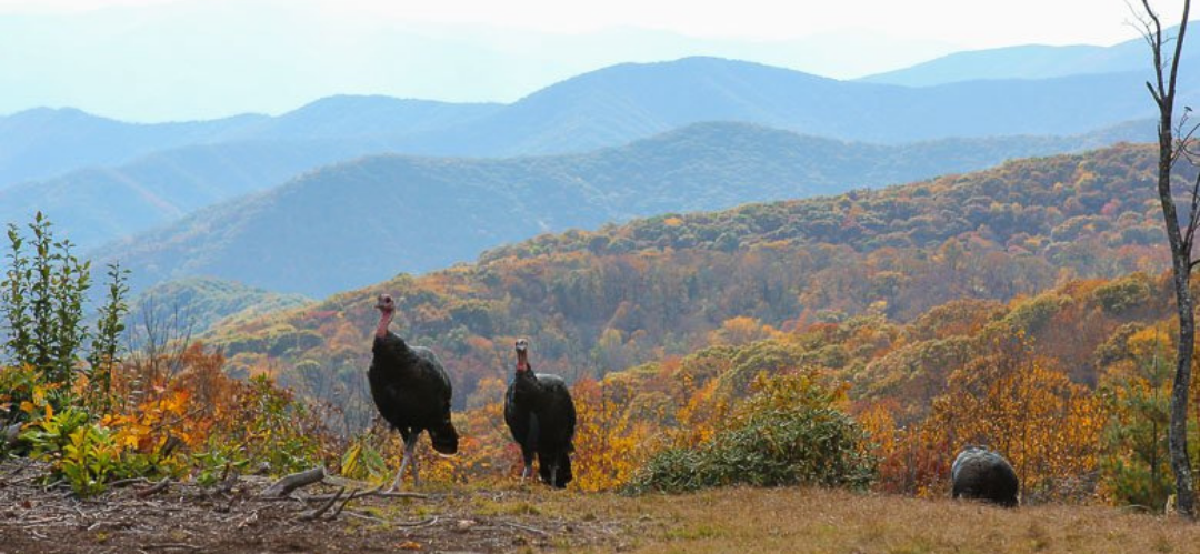
Through all that, you’ll get to view the old-growth forest and all the streams running between the trees. Expect to see plenty of fallen trees along the way as a result, especially after the storm season.
By the time you reach the top, you’ll be ready for a rest. Thankfully, the view of the Smokies will keep you captivated for however long you need to relax. Be ready for a challenging trek back down, as it demands a whole lot from your knees. You can ease the strain by keeping your trekking poles at the ready step after step.
Depending on your speed at either stretch, you could spend up to eight hours traveling along this route. If you end up captivated by the view from the top, you’ll be here for even longer.
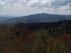
Rocky Top
For much more than a glimpse of all the gorgeous wildflowers growing in the Smokies, you’ll want to hike the Rocky Top Trail. This 10.5-mile path starts from the Lead Cove Trailhead and continues through the Bote Mountain Trail and right past the Appalachian.
You’ll get to follow the creek for the first two miles before hitting the Bote Mountain section of the trek. This path once served as a road in the mid-1800s and features a huge open area for frolicking through the flowers.
About 5 miles in, you can expect to travel through the dense woods where you have a chance at seeing local wildlife in action. Then, you’ll come out at the Rocky Top viewpoint. At this spot, you get a 360 view of all the major landmarks, ranging from Clingmans Dome to Mount LeConte.
If you take a lot of time to smell the flowers, expect to spend about six hours or more hiking this trail. You can extend your trip by hopping on the Appalachian Trail to check out two other viewpoints along this trail, which provides fantastic views of Cades Cove and the surrounding mountainside.
Russell Field — Spence Field Loop

Although strenuous, the Russell Field — Spence Field Loop is one of the best places to see the rhododendrons in full bloom, so you won’t want to miss it. You can take a ride along this trail on horseback if you cannot make it on foot. Either way, just be sure to watch out for all the roots and rocks, which can make each step truly hazardous if you’re not careful.
You’ll need to start this 13.3-mile loop at the Anthony Creek Trailhead and continue on until you reach the Russell Field Trail junction. From there, you take a right and start climbing up the loop for about 3.5 grueling miles.
At the 5-mile mark, you will come across short side trails, taking you up to a small meadow for a much-needed rest. After that, you’ll reach the Russell Field Shelter, which is where you want to take the Appalachian Trail back down to Spence Field.
If you don’t have lunch at the prior meadow, be sure to enjoy your meal at the field. The views are truly spectacular, treating you to the best of the Smokies while you fill up your belly for the rest of the way. Be prepared to have up to eight hours pass from the time you leave the trailhead to when you get back.
As you complete each of these challenging hikes, don’t forget to snag a selfie at the end as proof of your adventures. You’ll be able to look back at the photos in awe of your perseverance for years to come.
You’ll maybe even get to create a huge scrapbook of your accomplishments as you conquer more and more of the most difficult trails in the GSM and beyond. If you’re really up to the challenge, you’ll get to add the full Appalachian Trail to your itinerary, which can take an extraordinary seven months to hike from start to finish.