Oconaluftee River Trail Highlights
- Trail Features
River Walk, History
- Trail Location
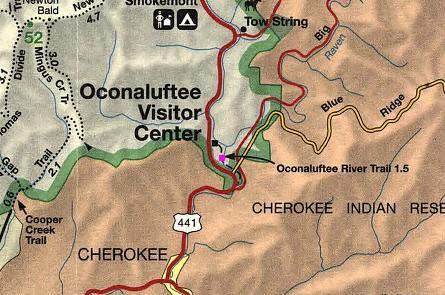
Oconaluftee Visitor Center
- Roundtrip Length
3.0 Miles
- Elevation Gain (total)
70 Feet
- Elevation Gain (per mile)
47 Feet
- Trail Difficulty
3.14
Easy
This easy hike is 3.0 miles roundtrip and includes 70 feet of elevation gain.
Oconaluftee River Trail Description
To reach the trailhead, walk behind the visitor center and head towards the Mountain Farm Museum. The Oconaluftee River Trail travels around the museum. Visitors will have the option of walking though the open-air museum first, as the trail can be picked-up at the far end of the museum.
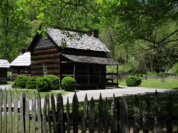
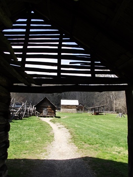
The Mountain Farm Museum is a collection of log buildings from various locations around the park. Most of the log structures were built during the late 1800's and early 1900's, and depict a typical farm from the Smoky Mountains region during this time period. The farmstead includes a furnished two-story log house, split rail fence, drovers' barn, pig pens, corn cribs, a working blacksmith shop, and several other outbuildings.
The Davis House (photo on the right) was built in 1900 from chestnut wood before a blight decimated the American Chestnut tree in the 1930s and early 1940s. The cabin was originally located north of Bryson City on Indian Creek.
The museum also demonstrates traditional gardening and agricultural practices, including livestock. For additional information be sure to pick up the self-guiding tour booklet at the visitor center.
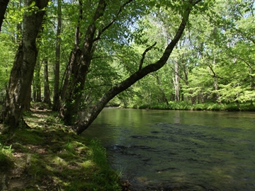
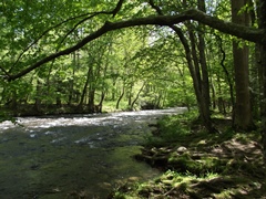
The trail itself is a pleasant walk along the Oconaluftee River.
The term "Oconaluftee" comes from the Cherokee word "egwanulti", which means "by the river," a reference to one of the oldest Cherokee villages that was once located along the river. Over time European settlers corrupted the Cherokee word in both pronunciation and spelling, and as a result, the word became Oconaluftee, and eventually grew to mean the name of the river itself.
Long ago the park service spread gravel along the trail as a result of the large number of visitors that hike this path. The Oconaluftee River Trail is also one of two trails in the park in which visitors can walk dogs and ride bicycles (the Gatlinburg Trail is the other).
As the trail meanders along the river bank it travels under the canopy of eastern hemlock, red maple, yellow buckeye, beech, sycamore, white basswood, dogwood and tuliptrees, among other varieties.
Late April is the best time for viewing wildflowers along the Oconaluftee River Trail. More than 40 species of wildflowers have been identified along this route, making this an outstanding choice for a hike during the spring or fall. During the springtime hikers can find several varieties of trillium and violets, jack-in-the-pulpit, purple phacelia, squirrel corn, stonecrop, phlox and crested dwarf iris, among many other varieties.
During the autumn asters are the main attraction in this area of the park.
In total, the trail travels for roughly 1.5 miles before ending at the national park boundary in Cherokee.
Oconaluftee River Trail Map
Directions to Trailhead:
The hike along the Oconaluftee River Trail in the Great Smoky Mountains begins just behind the Oconaluftee Visitor Center, located roughly 2 miles north of Cherokee, North Carolina on Newfound Gap Road (U.S. 441).