Meigs Creek Trail Highlights
- Trail Features
Waterfalls, Quiet Forest Hike
- Trail Location
The Sinks on Little River Road
- Roundtrip Length
7.0 Miles
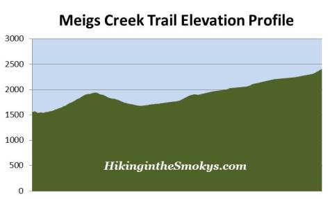
- Elevation Gain (total)
1380 Feet
- Elevation Gain (per mile)
394 Feet
- Trail Difficulty
9.76
Moderately Difficult
This moderately difficult hike is 7.0 miles roundtrip and includes 1380 feet of elevation gain.
Meigs Creek Trail Description
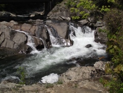
The Meigs Creek Trail begins from the Sinks, a popular roadside waterfall located just off Little River Road between Metcalf Bottoms and the Townsend "Y". The Sinks received its name from the swirling of water below the 15-foot cascade, which gives onlookers the impression that water is draining from a sink.
In 2010 the area surrounding the Sinks received a major facelift. The Park constructed a new viewing platform and renovated the parking area, which now includes stone masonry retaining walls, cut-stone walkways, and 21 paved parking spots.
Just beyond the viewing area is the official trailhead. After climbing a series of stone steps the trail immediately drops down and passes through a boggy wetland area. It then begins making a relatively steep climb over the western ridge of Curry He Mountain. After cresting the ridge, roughly eight-tenths of a mile from the trailhead, the trail levels out for a short distance where you'll have some decent views of the surrounding mountains - during the winter when there aren't any leaves on the trees. Shortly thereafter the trail begins a long descent down to Meigs Creek.
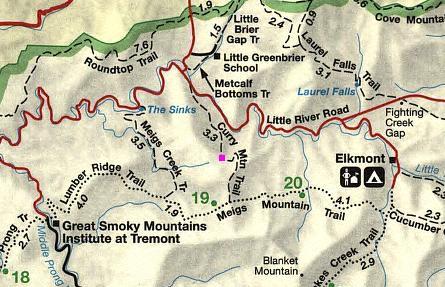
At roughly 1.4 miles the trail crosses Meigs Creek for the first time. From here the trail more or less follows the creek all the way to its headwaters along the northern slopes of Meigs Mountain. Along the way you'll pass several small waterfalls and cascades, including the 18-foot Meigs Creek Cascades (also known as Upper Meigs Falls), located roughly 1.7 miles from the trailhead.
In all, the trail crosses Meigs Creek, or one of its tributaries, on 18 different occasions - all without the benefit of a footbridge. During high water, or after heavy rains, this trail probably isn't a good choice, unless you're prepared to get your feet wet. If the creek is moving rapidly, crossing it will be difficult and dangerous. Hikers should probably consider turning around during these conditions. Late summer and fall is usually the best time to hike this trail, when water levels are much lower. No matter what time of year, however, it's probably a good idea to bring along trekking poles to help with balance.
The trail, creek and nearby mountain are all named after Colonel Return Jonathan Meigs, a Revolutionary War veteran, surveyor, agent to the Cherokee Nation, and military agent for the United States War Department. Meigs reportedly hung a bright-colored blanket atop a mountain towards the south, now known as Blanket Mountain, for use as a compass reference point.
Roughly 2 miles from the trailhead you should look for the first of two very large American Beech trees, which will be on your left near the confluence of Bloody Branch and Meigs Creek.
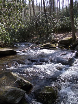
Much of the upper half of the trail passes through lush carpets of Partridge Berry, as well as several species of ferns.
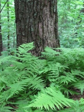
At 3.5 miles the trail finally reaches its endpoint at Buckhorn Gap, where it dead-ends at the junction with the Lumber Ridge Trail and the Meigs Mountain Trail. Backcountry Campsite 19 is located roughly 1.5 miles to the east on the Meigs Mountain Trail.
If you have two cars in your group you'll have several options for creating a one-way hike. One option is to continue on towards the Great Smoky Mountains Institute at Tremont via the Lumber Ridge Trail. You could also take the Curry Mountain Trail to Metcalf Bottoms, or you could hike the Meigs Mountain Trail to Elkmont.
Meigs Creek Trail Map
Meigs Creek Trail Elevation Profile
Directions to Trailhead:
From the Townsend "Y" intersection near Cades Cove, drive 5.8 miles eastbound on Little River Road to reach the parking area for the Sinks and the Meigs Creek Trailhead.
From the Sugarlands Visitor Center near Gatlinburg you'll drive 11.5 miles to reach the Meigs Creek Trailhead.