Shining Rock Wilderness
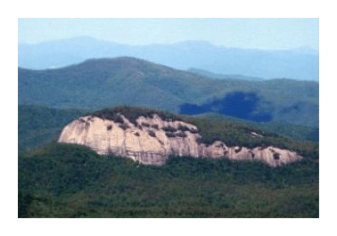
The Shining Rock Wilderness is a protected Wilderness Area in the Blue Ridge Mountains of North Carolina. The original tract of land was among the first protected areas in the National Wilderness Preservation System that was passed in 1964. Today, the Shining Rock Wilderness now includes a total of 18,483 acres, making it the largest Wilderness Area in North Carolina. This protected wilderness was later joined by the adjacent Middle Prong Wilderness Area in 1984.
Both Wilderness Areas are located in the Pisgah National Forest, and border the Blue Ridge Parkway where it forms a large V-shaped valley, roughly halfway between the Great Smoky Mountains and Asheville, NC. The Shining Rock Wilderness occupies the eastern half of the "V", while the Middle Prong Wilderness is located on the western half. The two areas are separated by NC Route 215.
The very steep and rugged terrain of the Shining Rock Wilderness includes five mountains that rise above 6000 feet. At 6030 feet, Cold Mountain is the highest point in the Wilderness. These mountains run along a 10-mile range known as the Shining Rock Ledge, which offer spectacular panoramic views and diverse natural habitats.
Meandering through the heart of the Wilderness is the renowned Art Loeb Trail, a National Recreation Trail that traverses over the highest peaks and balds, and can be used to reach the summit of Cold Mountain. The Art Loeb is considered by many to be one the most scenic trails in the region.
Hiking in the Shining Rock Wilderness
Almost all the trails in the Shining Rock Wilderness are rated as difficult. Additionally, some of the trails can be hard to follow in some places. Hikers should bring a good trail map with them before venturing out.
There are three main access points for trails within the Wilderness. The Black Balsam area near the Blue Ridge Parkway (near milepost 420) is the most popular. Although it's not part of the Wilderness itself, the Art Loeb and Ivestor Gap trails lead into Shining Rock from this location.
 Another popular trailhead is on the eastern side of the Wilderness, roughly 2.9 miles north of the Blue Ridge Parkway where US 276 crosses the Big East Fork Pigeon River. Several trails lead up the ridges into the heart of the Wilderness from here. Although the beginning of these trails are relatively easy, they become progressively more difficult the further you travel. The third trailhead is located in the Daniel Boone Boy Scout Camp on the west side of the Wilderness, located off of NC 215. This trailhead provides the nearest access to the summit of Cold Mountain.
The Art Loeb Trail
Although one of the longest and more difficult trails in N.C., the 30.1-mile Art Loeb Trail still ranks as one of the more popular routes in the area. And no wonder, traveling mainly along peaks and ridges, the trail offers many outstanding panoramic views along this spectacular route.
The trail is a memorial to Art Loeb, an activist from the Carolina Mountain Club, described as being a man who "deeply loved these mountains".

Along its route the Art Loeb Trail traverses several significant peaks, including Black Balsam Knob (6214 feet), Tennant Mountain (6040 feet) and Pilot Mountain (5095 feet). The trail also skirts along the base of Cold Mountain, which was made famous by the novel and Hollywood film.
Many hikers use the Art Loeb for extended backpacking trips, while others use shorter sections for day hikes, or use connecting trails to form several outstanding loop hikes. Most of the trail is overlapped by the Mountains-to-the Sea Trail, which is blazed with 3-inch white dots.
The trail is commonly divided into four separate sections:
Section 1: South of Pisgah Ranger Station to Gloucester Gap (12.3 miles)
Directions: Turn onto the road that leads to the Davidson River Campground, located roughly two-tenths of a mile south of the Pisgah District Ranger Station on U.S. 276 near Brevard. Hikers can park in the Art Loeb Trailhead parking area.
Starting from the Davidson River the trail ascends while following a WSW course to circle around Cedar Rock Mountain, and eventually reaches Gloucester Gap. This segment traverses up and down along a series of ridges and gaps.
Section 2: Gloucester Gap to Black Balsam Knob (7.2 miles)
Directions: Start from Gloucester Gap, located 4.5 miles west of the State Fish Hatchery on FS Road 475 (it's recommended that you not leave your car overnight here).
Proceeding from Gloucester Gap the trail swings WNW before ascending Pilot Mountain, the former site of an old fire lookout that offered panoramic views.
Beyond Pilot Mountain hikers will reach a shelter and natural spring at Deep Gap. The route then cuts across Farlow Gap, crosses over the Blue Ridge Parkway at Shuck Ridge, and then begins to make the steep climb up to Silvermine Bald, which tops out just below 6000 feet in elevation. From Silvermine Bald you'll make the short climb to FS Road 816 on Black Balsam Knob.
Section 3: Black Balsam Knob to Deep Gap (6.8 miles)
Directions: From U.S. 276, drive 8 miles south on the Blue Ridge Parkway and turn onto FS Road 816. Travel another mile to the crest of the hill and look for a small pull-off. The trail crosses over the road near this small parking area.
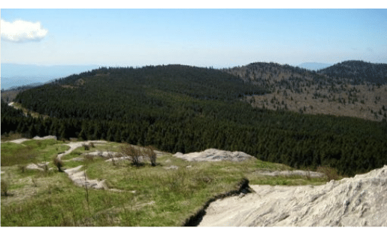
Many people regard the first half of this section as the most spectacular segment of the Art Loeb Trail. The trail crosses over two peaks that top out above 6000 feet: Black Balsam Knob and Tennant Mountain. At Black Balsam Knob, the trail's highest point at 6214 feet, is a plaque commemorating Art Loeb.
Beyond Black Balsam the route enters the Shining Rock Wilderness and crosses over several balds, including Shining Rock itself. This section of the Art Loeb Trail ends at the intersection with the Cold Mountain Trail at Deep Gap.
There are several campsites along this section should you decide to stay overnight. Additionally, an outstanding 5-mile loop can be created by combining the Art Loeb Trail with the Ivestor Gap Trail.
Section 4: Deep Gap to Daniel Boone Boy Scout Camp (3.8 miles)
Directions: This section begins from the Daniel Boone Boy Scout Camp, located off NC 215 (Lake Logan Road), four miles south of Bethel, NC. Hikers should notify camp staff if you plan to leave your vehicle overnight.
Although short, this section of the Art Loeb is very steep. It leads to the Cold Mountain Trail, a spur that leads to the summit of the highest mountain in the Shining Rock Wilderness. Hikers should note that there are no signs or trail blazes along this stretch of trail.
Other Trails in Shining Rock Wilderness
Big East Fork (Number: 357), 3.6 miles. This is a fairly difficult hike that follows the Big East Fork of the Pigeon River. The trail offers many picturesque river scenes along this route. It's heavily used near the beginning, but traffic diminishes the further you travel.
Cold Mountain Trail (Number: 141) 1.4 miles. The Cold Mountain Trail is a strenuous spur trail that leads off from the Art Loeb Trail. Due to tree cover there are no views from the 6030-foot summit. However, if you backtrack about 10 yards down the trail from the top you'll find a short spur trail on the left that leads to a rock ledge that offers an incredible 180-degree view towards the south. The Cold Mountain Trail is very steep, ascending over 1000 feet in the 1.4 miles it takes to reach the top.
The summit of Cold Mountain is normally reached by one of two hikes:
* The easier, but longest option, is from the Black Balsam area near the Blue Ridge Parkway. This is an 8.2-mile one-way hike, but the elevation gain is minimal. See Section 3 of the Art Loeb Trail for more information.
* The second route is a little shorter (5.2 miles one way) but is much more strenuous. From the trailhead at the Daniel Boone Boy Scout Camp, the combined Art Loeb and Cold Mountain Trails climb roughly 2800 feet before reaching the summit. The Cold Mountain Trail splits off from the Art Loeb Trail roughly 3.8 miles from the trailhead. The final 1.4 miles to the summit climbs roughly 1000 feet. See Section 4 of the Art Loeb Trail for more information.
Fork Mountain Trail (Number: 109) 6.2 miles. A little used but strenuous trail that begins off U.S. Highway 215, just south of the Daniel Boone Boy Scout Camp.
Greasy Cove Trail (Number: 362) 3.2 miles. Also known as the Grassy Cove Trail, this is a difficult, steep hike to Grassy Cove Ridge. The trailhead is located off FS Road 816, which is near Black Balsam Road off the Blue Ridge Parkway.
Ivestor Gap (Number: 101) 4.3 miles. This is the only trail considered to be easy in the wilderness area. Ivestor Gap is a relatively level trail that follows an old railroad grade around Black Balsam and Tennant Mountains. The trail passes through several bald areas where only rhododendron, mountain laurel, and blueberries grow. The blueberries grow in abundance and are usually ripe around mid-August. Please note that horses are allowed on the trail. It's also open to four-wheel drive vehicles during the fall.
Little East Fork (Number: 232) 5.4 miles. Strenuous but little used trail that begins out of the Daniel Boone Boy Scout Camp.
Old Butt Knob (Number: 332) 3.6 miles. A very strenuous trail that splits off the Shining Creek Trail roughly seven-tenths of a mile from the trailhead. It's a very steep climb to Old Butt Knob, but traverses relatively moderate terrain from there to Shining Rock. Hikers will enjoy outstanding views from both of these vantage points.
Shining Creek (Number: 363) 3.4 miles. Difficult hike. Hikers can combine this trail with the Old Butt Knob to create an excellent loop hike.
Middle Prong Wilderness Trails
Buckeye Gap Trail (Number: 126) 4 miles. Strenuous trail. Hikers can combine this with the Haywood Gap Trail to create a long loop hike that will take you into the heart of the Middle Prong Wilderness.
Green Mountain (Number: 113) 5 miles. Very rough and difficult trail that climbs steeply from the river valley to the top of Green Mountain, and then travels along Fork Ridge. This is a scenic hike that travels through a variety of forest types.
Haywood Gap Trail (Number: 142) 5.8 miles. Difficult trail that travels through a mixed forest of rhododendron groves and forests of birch and maple, as well as some spruce and fir. The trail starts from the Blue Ridge Parkway and traces the head of the Middle Prong of the West Fork of the Pigeon River.
Key Links:
US Forest Service: Shining Rock Wilderness